According to the UNCLOS, which the vast majority of countries on earth have signed, in most cases, a country’s jurisdiction only extends 200 nautical miles from shore.
In order to have the level of freedom that Freedom Haven seeks, we will need to remain far outside the Exclusive Economic Zone (EEZ).
Since “International Waters” means everything outside of 12 nautical miles, it is NOT the correct term to use in this context.
We’ve considered several in various locations, including:
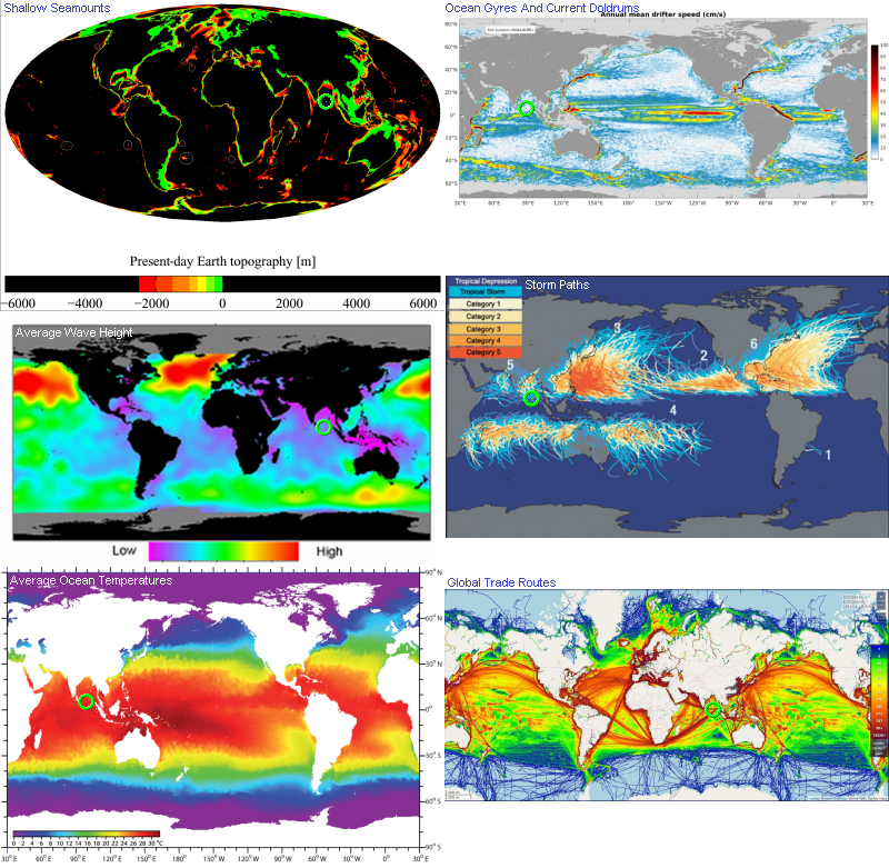
Shallow Seamounts
(Image modified from original wikimedia source image)
There are a number of locations (outside the EEZ) where the seabead is shallow enough to anchor to.
Ocean Gyres And Current Doldrums
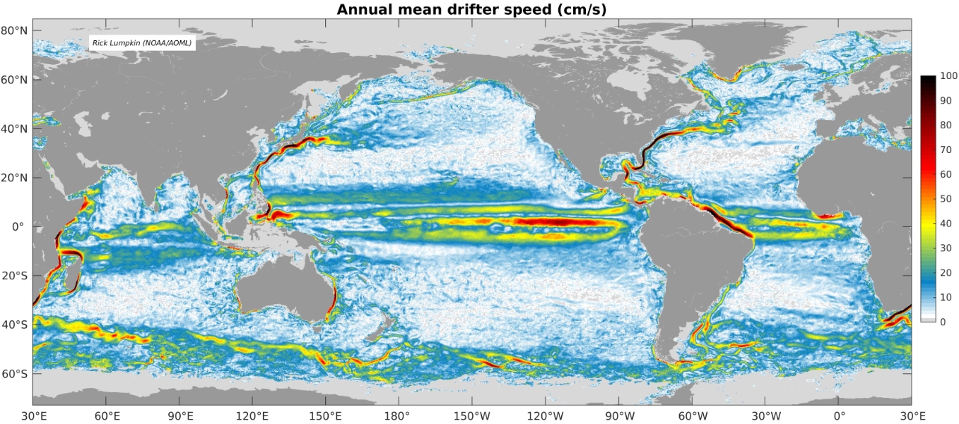
(Image source: NOAA.gov: climatology.jpg)
White sections of the map show places with the lowest average annual ocean current speeds, although NOAA’s current animations give give a better understanding on how these change throughout the year. Spots with a slow enough current won’t need any anchoring and only minor engine corrections.
Average Wave Height
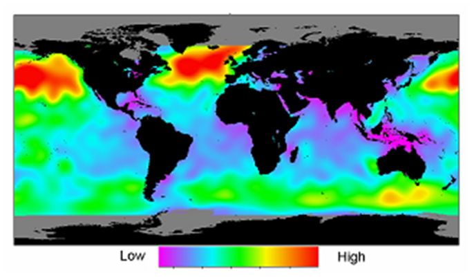
(Image source: ResearchGate.net)
The north sea is a bad idea. Purple areas are best.
Storm Paths
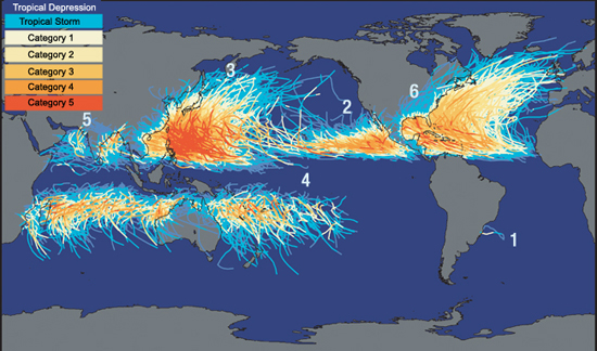
(Image source: CoolGeography.co.uk)
There are areas of the world (like to the east and west of South America) where almost no storms have ever been recorded, making these (and other similar) areas vary attractive to some.
Note: this image shows the paths of the centers of the storms, not the areas affected by the storms.
Average Ocean Temperatures
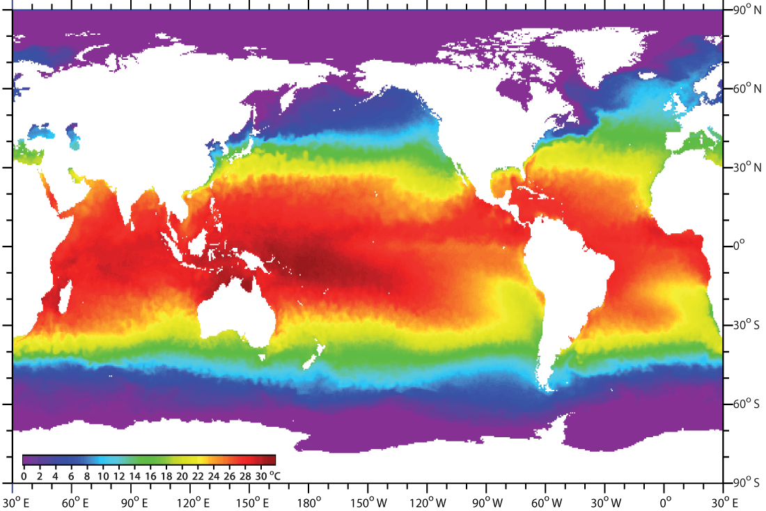
(Image source: SEOS Project)
There are some sections of Antarctica that remain unclaimed by any country to this day. Why? Because it’s too cold to really prosper there. Temperature is important to consider when choosing a location.
Global Trade Routes
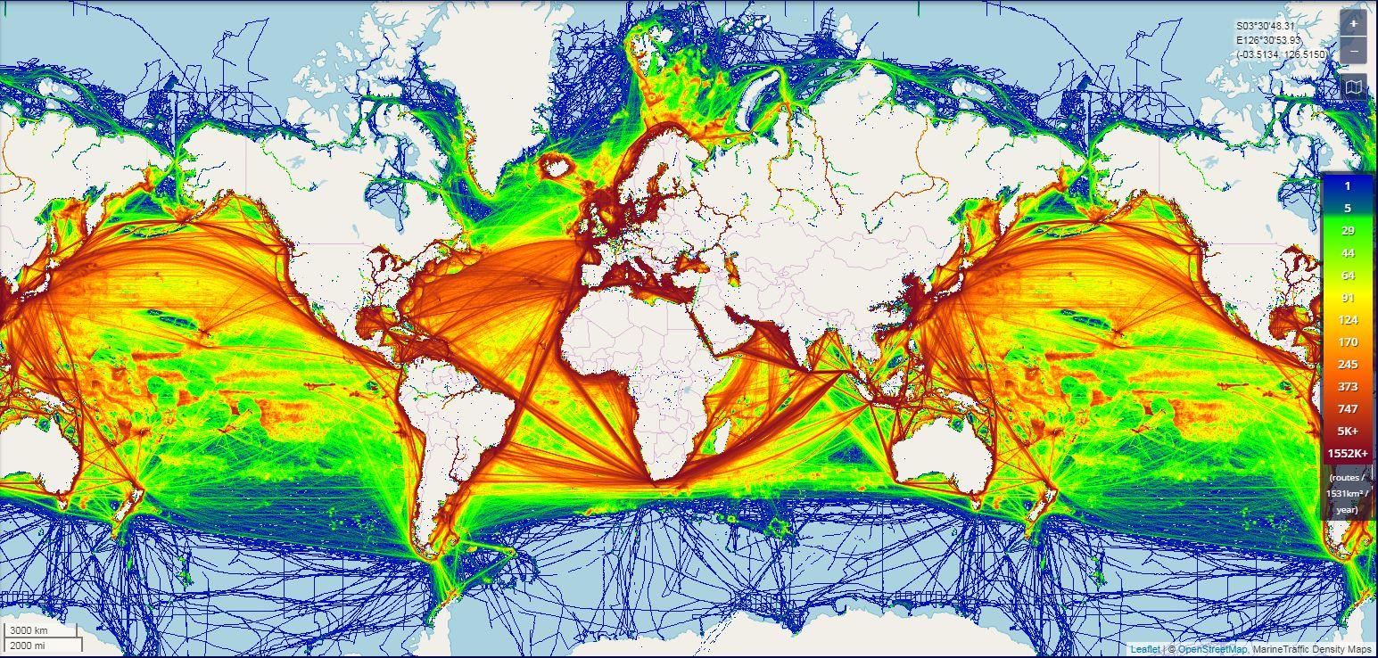
(Image source: Reddit)
One important thing to consider is where the container traffic is. The closer we are to this traffic, the faster and cheaper our imports and exports will be.
Option: South Bay Of Bengal
We are currently considering the southern end of the Bay of Bengal.
More discussions on this at our “Creating a Libertarian Seasteading Micronation” facebook group.
